


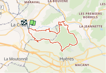

12,5 km | 19,9 km-effort

Gebruiker


Gratisgps-wandelapplicatie
 SityTrail
IGN / Geografische instituten
SityTrail World
De wereld gaat voor u open
Tocht Stappen van 18,1 km beschikbaar op Provence-Alpes-Côte d'Azur, Var, La Crau. Deze tocht wordt voorgesteld door cdanielrando.
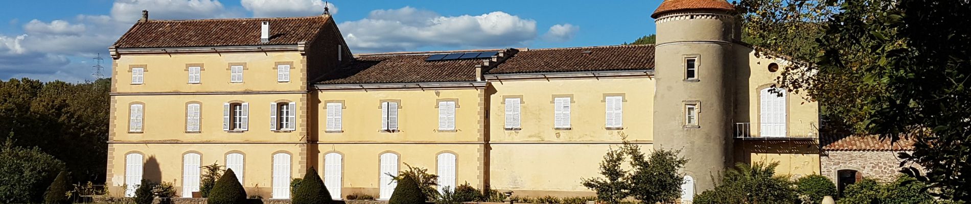
Un beau circuit qui peut-être amélioré en visitant les ruines du vieux château d'Hyères. Le château de la Roquette étant une propriété privée il vaut mieux demander l'autorisation de rentrer avant d'aller prendre des photos comme celles proposées


Stappen

Stappen

Trail

Trail

Trail

Stappen
Stappen

Stappen
Stappen
superbe. merci